
C2C – Day 6: Thursday 7 April – PATTERDALE to SHAP (17 miles)
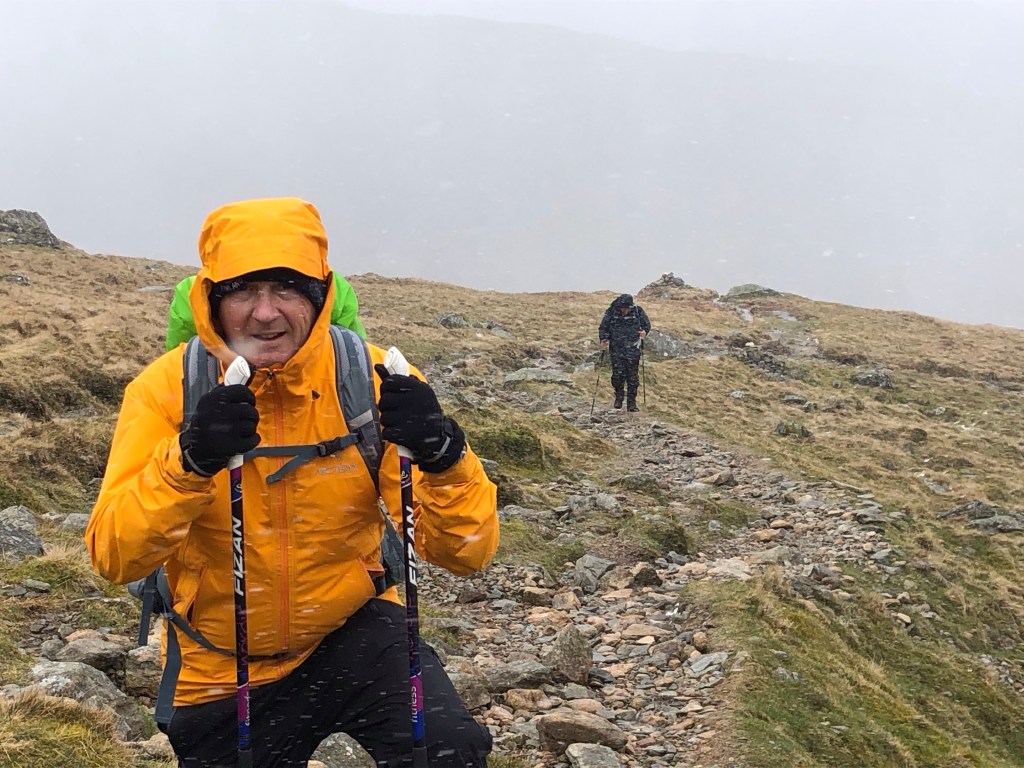
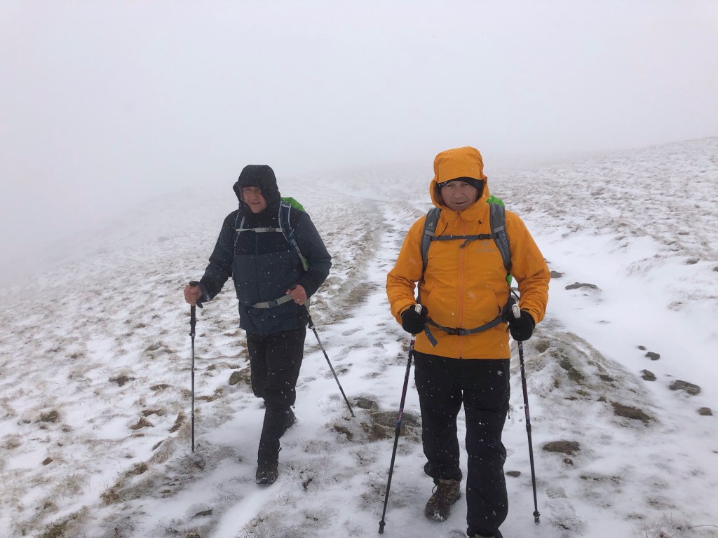
Today was to have been the first day that just the two of us, Rob and I, walked together unaccompanied. However on leaving our Patterdale guesthouse we bumped into a fellow C2C trekker, John, who we had met a number of times on the trail, and so it was that we became a new team of three for the day! As it turned out it was great to have John with us, for his good company and for mutual support, as today’s walk became the most challenging to date and potentially of our whole C2C journey!
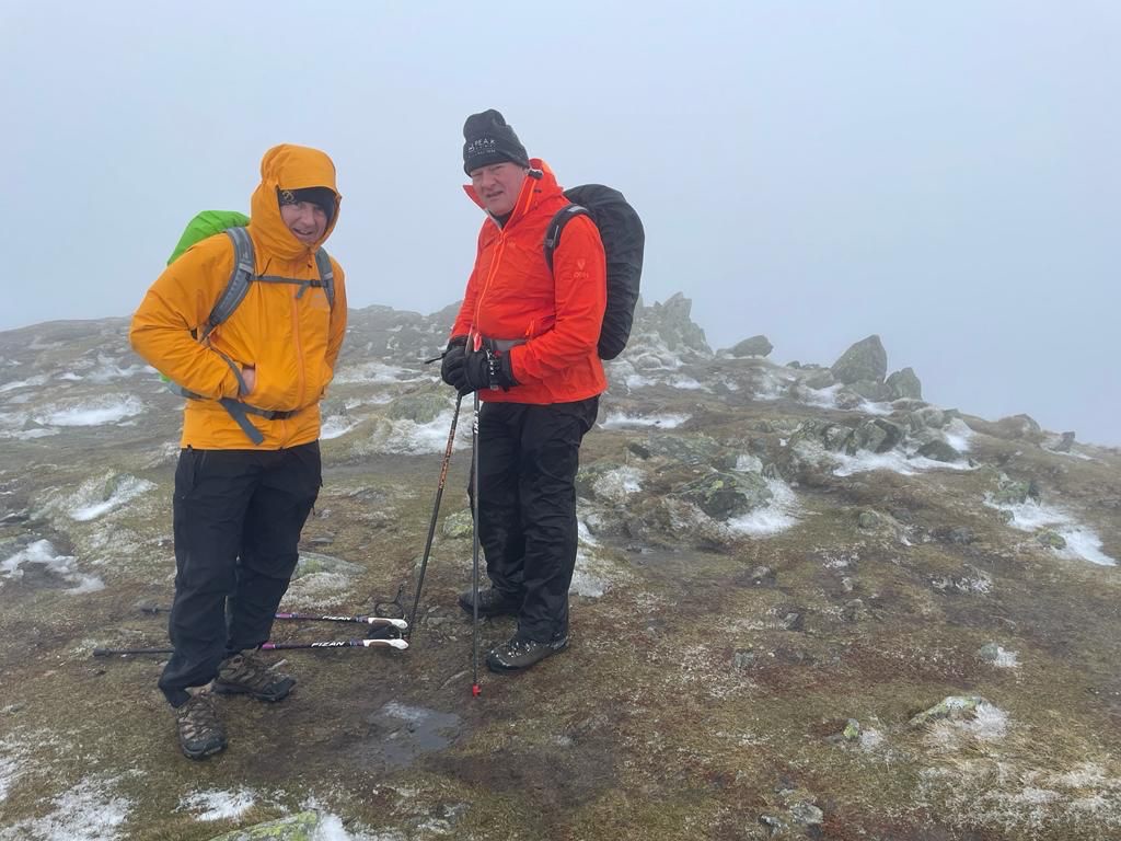
Certainly the weather did little to help us on our way today, but it was all rather part of a unique and very memorable experience. An early hail shower hastened us into donning our waterproofs and heralded a day of mist and wintry showers on a strong northerly wind that was to culminate in a full-blown storm during the afternoon. And just to complete this meteorological lexicon we finally had an hour of welcome sunshine to dry us out a little as we approached our destination.
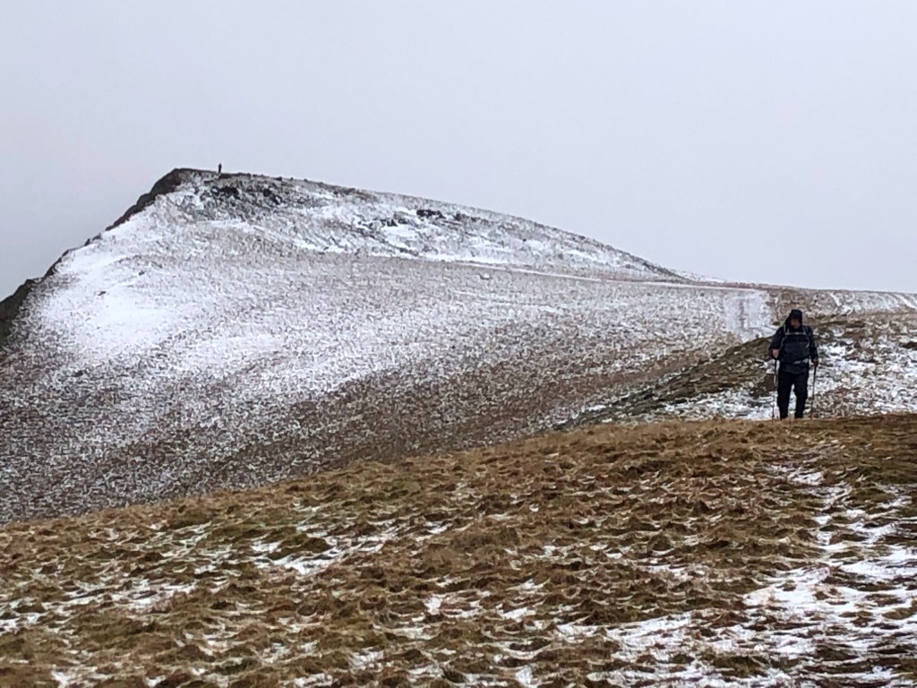
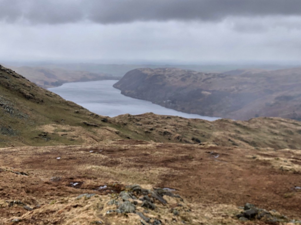
Today’s walking route took us up high above Patterdale, first to Angle Tarn, and then on another steep climb past the small summit of The Knott, before a more gradual rise to Kidsty Pike. This peak, at 780 metres, is the high point on the entire C2C route, and our photos tell their own story!
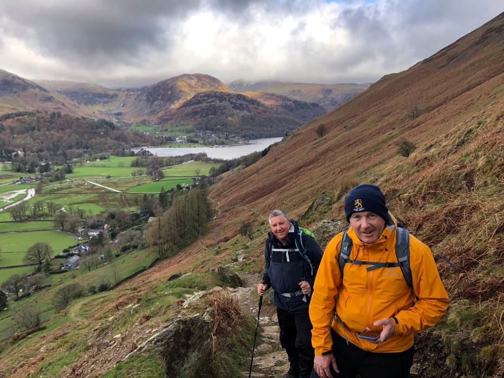
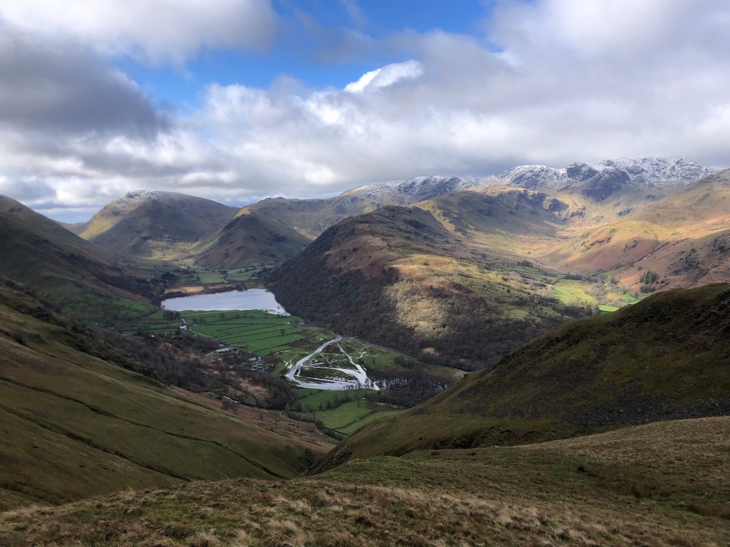
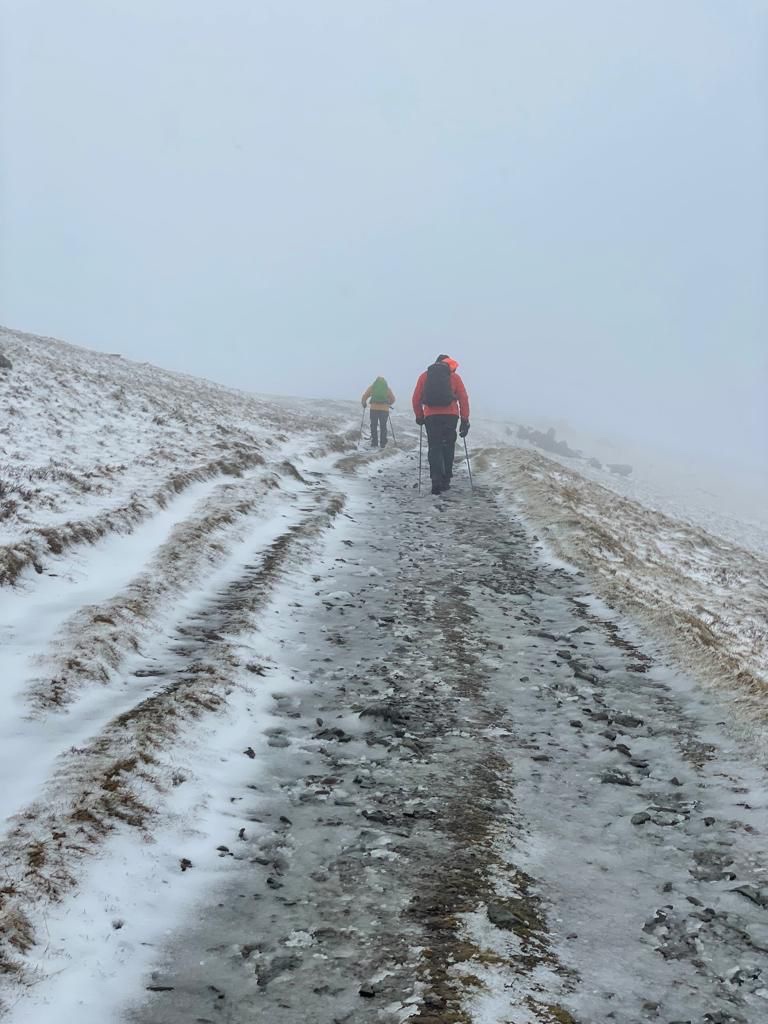
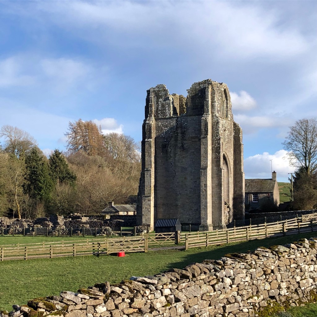
From this high ground we descended steeply past Kidsty Howes and then down to the south-west corner of Haweswater. Next followed a two-hour traverse of the tortuous path along the northern shore of the lake, to the dam at its far end. At this point we left behind the fells for an easier walk through forest and along the Haweswater Beck, before an undulating few miles over pastures. Such a change in scenery provided a pleasant end to the day’s marathon, especially, passing the ruins of Shap Abbey, when the clouds parted and the sun at last broke through to warm our tired limbs. Thus, exhilarated, we walked the final mile along the minor roads into the village.

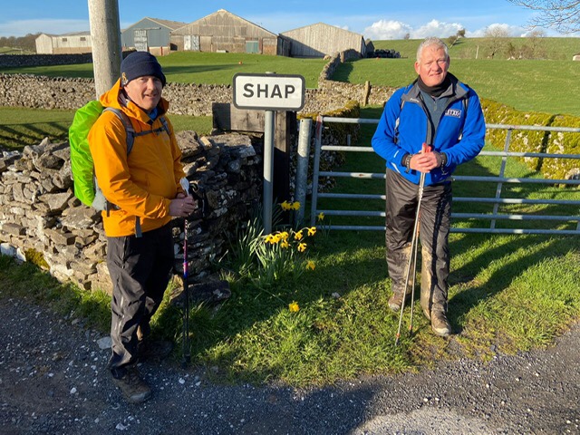
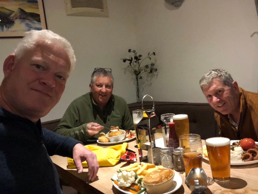
Our 17 miles today had taken us over nine hours, and as we arrived in Shap around 6.30 pm we reflected with some satisfaction that we have now walked right across the Lake District and into a very different region. So far Rob and I have covered nearly 70 miles, around a third of our likely C2C total, and we have completed four climbs of over 600 metres. We celebrated with a pub meal and a well-earned early night!
And up ahead, to the east, the snow-clad Pennines now beckon us on – the next chapter in our challenge! We have a forecast of sunshine for tomorrow with good visibility, and a much shorter walking day in prospect!

Amazing scenery! And what challenging terrain and conditions! Wishing you better and more spring like weather from now on.🤞🤞
LikeLike
Wow, that looked a tough day, well done boys! Fantastic photos, following you all the way! 👍
LikeLike
Superb job! Looked very cold and bleak at points but what an achievement- I’d have been going round in circles in that mist.
LikeLike
This is one of my favourite parts of the Lake District and I have walked extensively in the Far Eastern hills.The picture of Angle Tarn made me smile as I swam there in 2018.The conditions yesterday were plainly challenging and it does you credit to have got through it so succesfully.Enjoy the Western dales as the weather looks to be improving.
LikeLike
Ouch! Talk about toughing it out, eh?
LikeLike