
Tuesday 6 June 2023
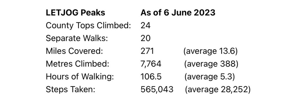
Having achieved the numerical halfway point on my LETJOG Peaks challenge, of 24 County Tops conquered during the last three months, I have a day of quiet reflection today while I look at my calendar and decide which of the remaining peaks to tackle next and how to access them. The figures suggest, at least superficially, that I am well on course to achieve my goal of completing the ascent of all of the 48 shire summits by the year end, but the logistics are getting trickier now. The map below shows the spread of my walks to date, and (the Peak District aside) it is dominated by the counties closest to home around the south-east of England that tend mostly to be in the lowlands. So trips further afield beckon now, with tougher climbs and the associated prospect of more variable weather in the higher regions.
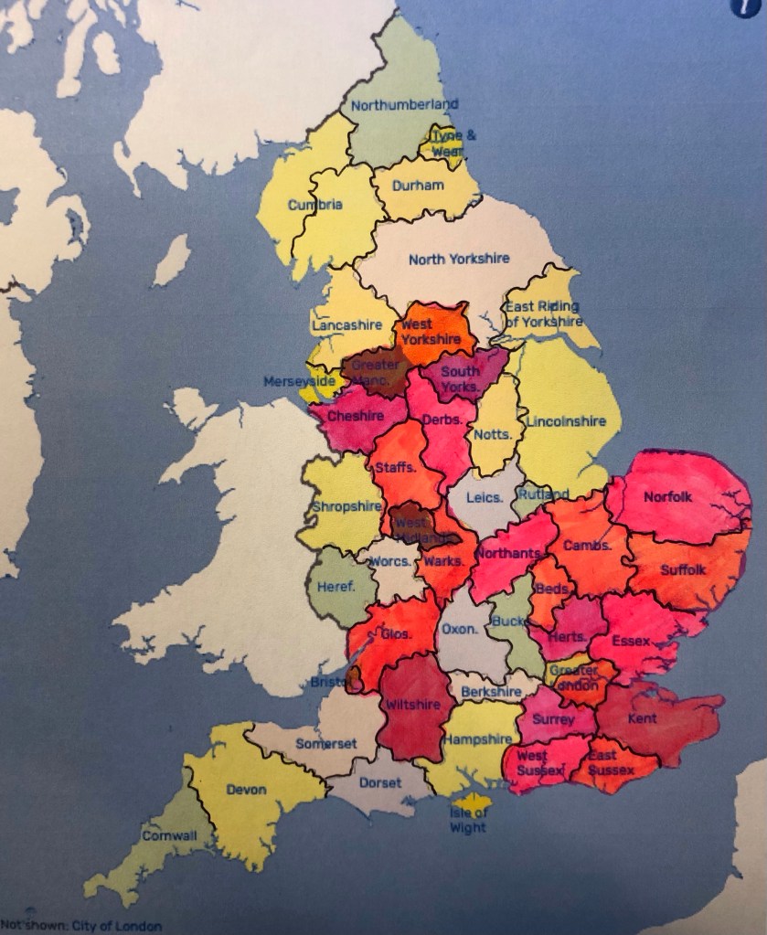
As the map indicates, by sub-dividing Cumbria and Greater London, I have decided now to add two more counties to my challenge, respectively Westmorland and Middlesex, thus increasing my prospective County Tops from 48 to a nice round total of 50! Whilst neither of these additional shires is currently a Ceremonial County (as defined by the 1997 Lieutenancies Act, being the guide that I have adopted) they are both historic counties that continue to be recognised – in the case of the former by its recent re-designation as a part of the new local government district of ‘Westmorland and Furness’, and by the latter’s endurance through to the present day (notwithstanding the formal abolition of the county name last century) via such historic strands as Middlesex County Cricket Club.
So, of my new target of 50 County Tops I now have 26 more to conquer. My figures for the peaks I have achieved to date are as follows:

For those who have only recently started reading my Blog I thought it might be useful to include a quick reminder of the topographic terminology that I have been using (text taken from my earlier Blog ‘Can’t Stop Now’ covering my walk on 22 March).
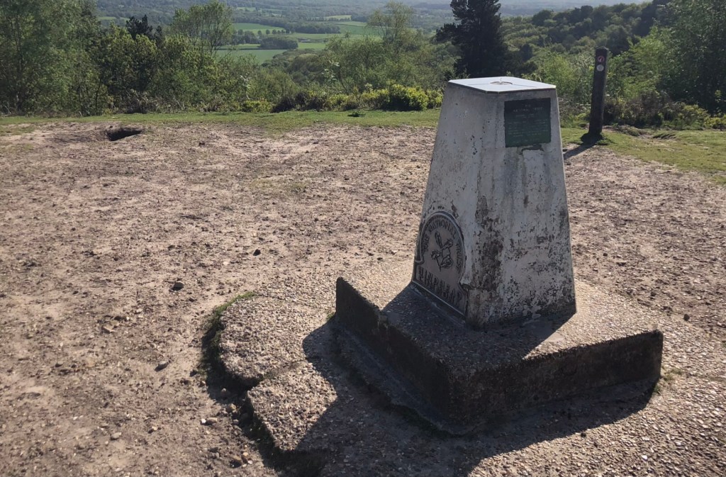
When speaking of the height of a hill, such as in my regular Blog headings, I refer usually to its absolute elevation. This vertical distance is taken from the Ordnance Survey (OS) measurements of GB Mean Sea Level using datum levels based on established tidal gauge readings at Newlyn in Cornwall. Standard OS mapping relies on this data and depicts elevation via contours and spot heights, measured in metres. Trigonometrical (or ‘trig’) points, small concrete pillars topped by a graven metal plate for mounting a theodolite, are found across the country, providing a network of universal surveying stations of fixed location and height. For convenience and familiarity I follow these metric height measurements – alongside my imperial mileage measures such inconsistency perhaps betrays my hybrid thinking! Finally, as regards height, I refer on occasions to my cumulative climb for a particular day’s walk, and this of course is the total of all of the uphill sections for that day (as measured on my daily map plot on the OS App).
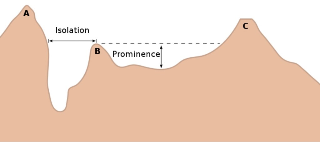
‘County Top’, a term I have already used in this Blog, is established and self-explanatory terminology for the peak of a shire, and it is these peaks upon which my challenge is based. However, other topographical terms, such as prominence and isolation, may perhaps give a better guide to the apparent size and ‘impressiveness’ of a hill or mountain. Topographic prominence refers to the elevation of a summit relative to its surrounding terrain, and more particularly to the peak’s height measured to the lowest contour line surrounding it but containing no higher summit within it (or put another way, the prominence of a peak may be defined as the least drop in height necessary in order to get from the summit to any point of higher terrain). Isolation measures the minimum horizontal distance from a given summit to any other point of greater or equal elevation. These measures are used by mountaineers and walkers, and others, to gauge the subjective significance of a given peak. The following diagram (courtesy of Wikipedia) best explains all of this.
I also refer to some peaks as ‘Marilyns’. In my Blog ‘High And Dry’ covering my walk on 19 April I explained the origins of this moniker, used in recent years to describe British summits enjoying a prominence of 150 metres or more, irrespective of absolute height, again as a subjective indicator of our country’s most impressive peaks. So far in this challenge I have climbed seven Marilyns (Kinder Scout in Derbyshire, Black Hill in West Yorkshire, Shining Tor in Cheshire, Cleeve Hill in Gloucestershire, Leith Hill in Surrey, Black Down in West Sussex, and Ditchling Beacon in East Sussex), and I have another 19 yet to climb amongst the 26 remaining peaks – another imbalance suggesting that the second half of my venture is likely to be more challenging than the first!
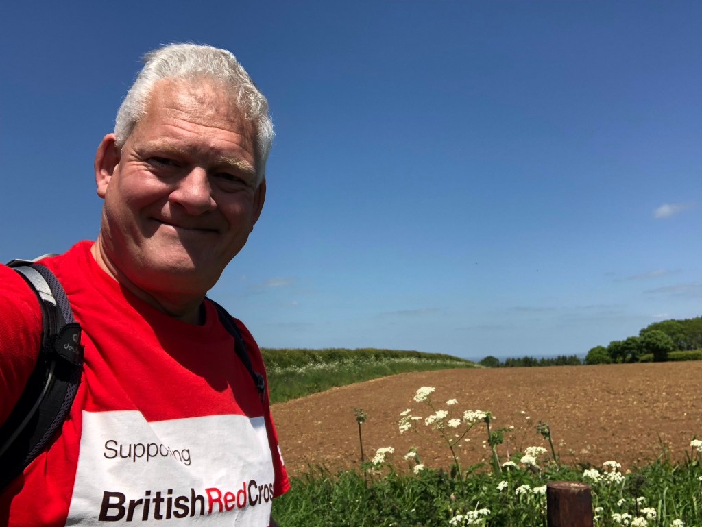
Aside from the personal challenge the reason of course that I am doing all of this is to support the British Red Cross’ Ukraine Crisis Appeal.
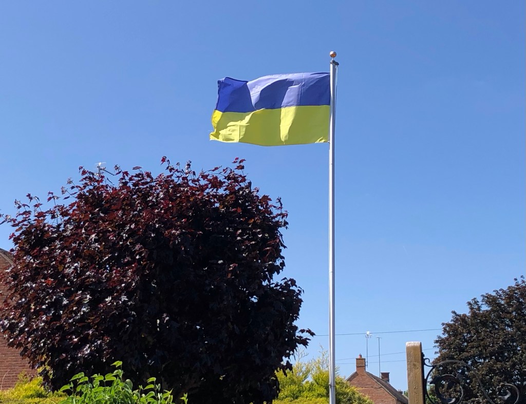
As you know, the humanitarian situation in Ukraine continues to be desperate, with some millions being displaced from their homes and many more still taking cover from the shelling in the cities. The British Red Cross has been at the forefront in providing critical humanitarian aid on the ground in Ukraine, and their teams have been working flat out to get critical care to those who need it most, both in Ukraine and its bordering countries, as well as those finding their way in the UK. With the ongoing violence an enormous number of people urgently need help right now, and in order to support the vital humanitarian work of the British Red Cross, both on the ground in Ukraine and also in aid of Ukrainian people now in the UK, I have set up a JustGiving page for those who wish to support their work. This can be reached via a direct link on my HOME Page above, or by clicking on the following link. Thank you all, in anticipation.
“We’re so grateful for people like Nick, undertaking challenges such as this. The money raised helps us to support people in their times of crisis, and for this we thank you for your support”. Liz Craig, Regional Fundraising Manager – South East, British Red Cross.
So now I will get back to my planning of the next phase of my LETJOG Peaks challenge. I have forthcoming trips this month to the South West and to the Lake District, both into the higher ground of upland England. I will of course keep the Blogs flowing, so please continue to follow my journey and feel free to pass on the details of my website to anyone who may be interested in reading these missives. With many thanks for your messages and support – I will be right back shortly with the Second Half.
Today’s Blog heading ‘Man In The Middle’ follows the title of a 2001 song by the Bee Gees, from their 22nd and final studio album ‘This Is Where I Come In’. Written by Barry and Maurice Gibb and featuring lead vocals by the latter, along with third brother Robin the trio were raised originally in Manchester before the family emigrated to Australia. As their musical careers developed the brothers returned to England in 1967, going on to become one of the best-selling music acts of all time with worldwide sales of over 220 million records. The lyrics of the song ‘I’m just the man in the middle of a complicated plan’ seem to reflect quite well my current deliberations over how to access my remaining ‘LETJOG Peaks’.

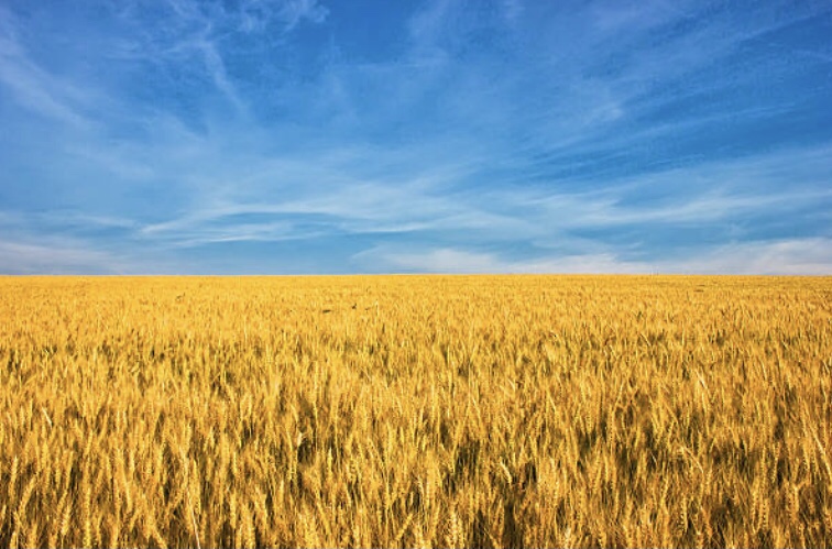
* NB. Two of the photos above (the ‘Terminology’ image and the Ukrainian golden cornfield) are freely-available stock images from the internet, the ‘Prominence and Isolation’ diagram is copied from Wikipedia, and the British Red Cross logo is of course their own. All other photos and images, in keeping with those in my regular Blogs, are my own work.

Hi Nick,
<
div>Following your progress. We hope when you visit Westmorland
LikeLike