
Monday 25 March 2024
With the arrival of spring it is great to be back blogging after a few weeks’ pause for breath, and thank you all for joining me once again on these pages. Despite my inactivity with a pen, my walking has not stopped, as I have been enduring one of the wettest and muddiest of recent Marches in an effort to get fit for my forthcoming walking adventure.
It has taken me a few weeks longer than I intended to commit to this new trek; a combination of a busy two months, various logistics to sort, and mostly a lack of moral fortitude to go public with my plans. But the day has now arrived for me to share my latest challenge.
Announcing LETJOG E2W!
Many of you kindly followed my travels three years ago, as I set out on foot, solo and unsupported, to walk the approximate 1,100-mile path from Land’s End in Cornwall to John O’Groats in north-east Scotland. This ‘LETJOG’ journey has been attempted, and achieved, by a good few hardy walkers over the years, albeit that there is no prescribed path and that each chosen route is likely to have been completely unique. Reflecting on this renowned ‘End-to-End’ ramble it occurred to me a while ago that there is no acknowledged ‘horizontal’ east-to-west equivalent of the south-to-north trek, no accounts of a trail to link the two most diverse longitudinal points of our islands. Or certainly not so far as I have been able to ascertain to date.
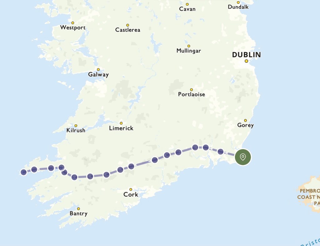
My investigations soon revealed the easterly extremity of the British Isles to be Lowestoft Ness on the North Sea coast of Suffolk (at a longitude of 1.76 degrees East), whilst its most western mainland counterpoint is Dunmore Head on the Dingle Peninsula in the west of the Irish Republic (at 10.48 degrees West). So to attempt an East to West trek between these two points, somewhat over 600 walking miles apart, seems a worthy escapade – in my own eyes at least. LETJOG E2W here I come!
Unlike my LETJOG 2021 trek, and in the absence of any extreme ability in sea swimming on my part, this journey must necessarily entail a ferry crossing over the Irish Sea; there are options to cross from Holyhead on Anglesey to Dun Laoghaire near Dublin, or from Pembroke or Fishguard in west Wales to Rosslare in County Wexford in the very south-east of Ireland, and of these the Fishguard to Rosslare route is the shortest, a sailing of around 94 miles. So my E2W trek will lead me from Lowestoft eastward to Fishguard for the ferry to Rosslare in Ireland, and thence to walk to the Dingle Peninsula on the extreme west of the ‘Emerald Isle’. I am scheduling a start date of Sunday 14 April from Lowestoft, and I hope to complete the walk around six weeks later, towards the end of May.
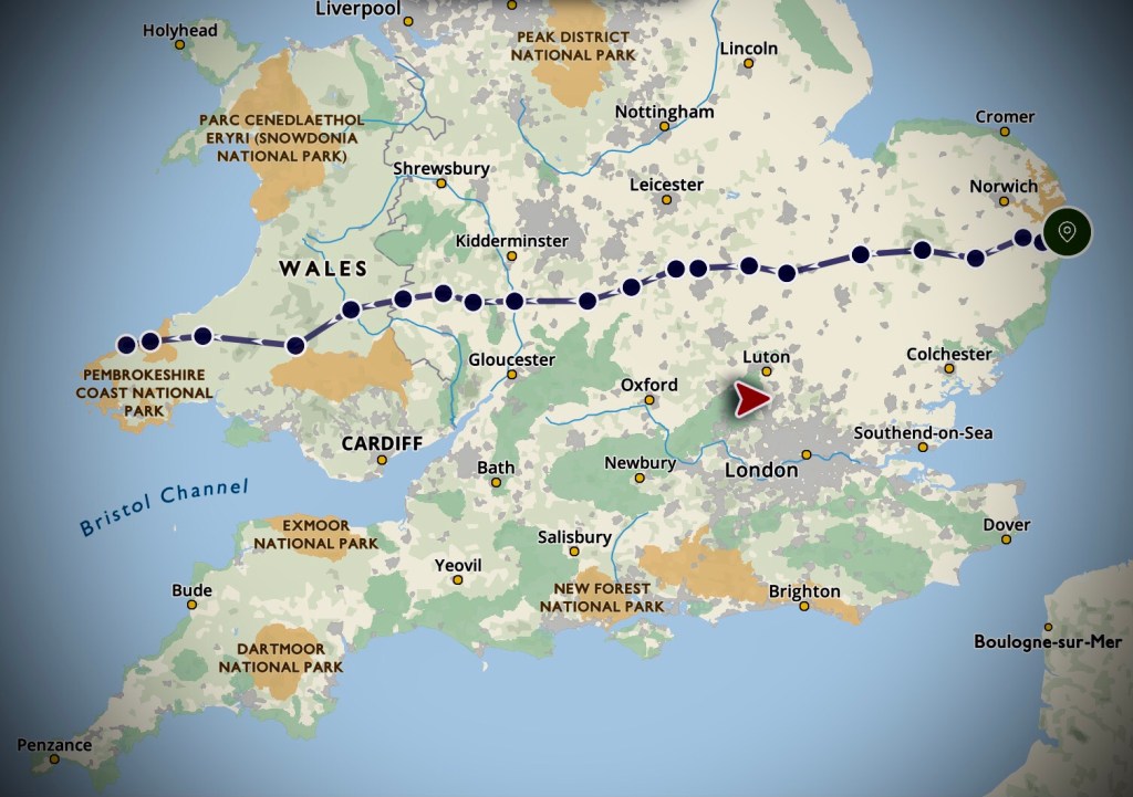
My challenge has been set, and over the last few weeks, between walks in the Chilterns, in Norfolk, and in Essex’s Epping Forest, I have steadily been mapping out the daily sections of the journey. Perhaps unwisely, given the usual prevailing weather, I have elected to walk east to west: my primary motive for doing the trek in this direction reflects a desire on my part to complete the familiar parts of the journey first, before adventuring into the exciting unknown. I may well come to regret this psychological incentive when facing the rain on the inevitable driving westerlies at certain points along the way!

So there we have it – a trek of around six weeks covering over 600 miles and around 15,000 metres of ascent. My average mileage is scheduled at about 16.5 miles per day (so perhaps six hours of walking plus breaks), although a couple of the days through Wales are significantly longer, up to 24 miles and with over 1,000 metres of ascent, due to the sparse opportunities for accommodation in the Welsh hills. As with my LETJOG 2021 trek I will be walking solo and unsupported, carrying my own kit and staying in pubs, B&Bs, hostels, or anywhere else that will have me! And of course I will, as ever, be armed with my nordic poles.
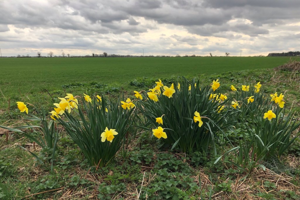
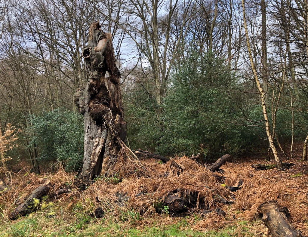
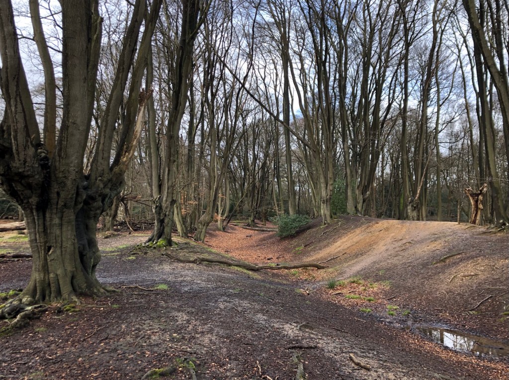
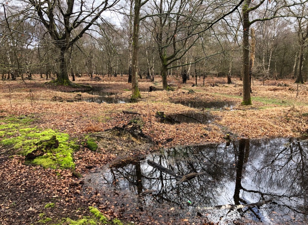
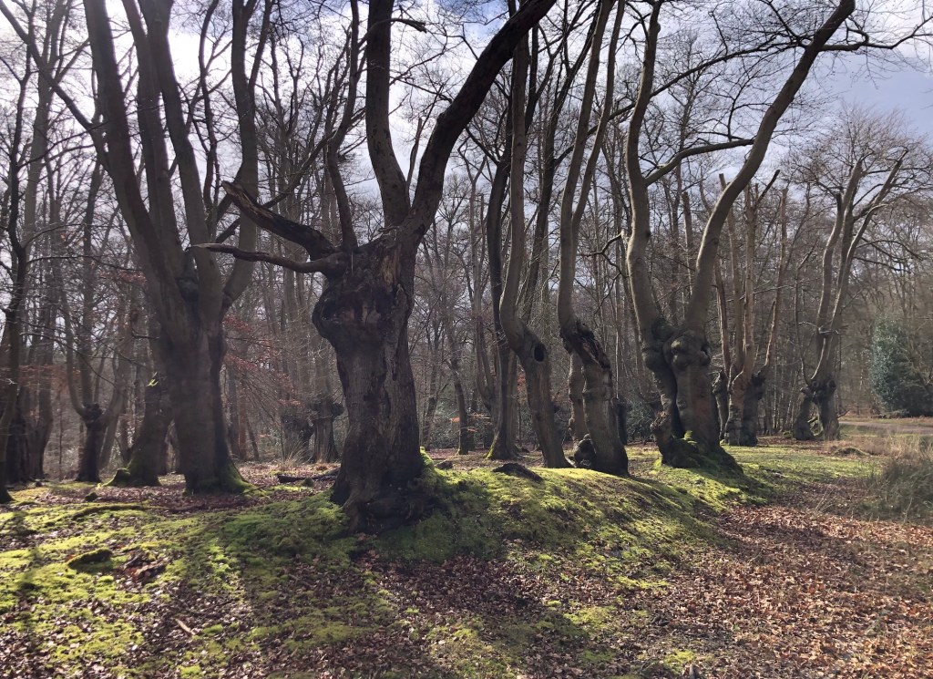
I will post some further details of my proposed walk in the next few days, but for now I have just under three weeks left to prepare for the walk; assembling kit, refining my walk plans, travel and accommodation arrangements, and continuing with my training. I have a trip to Cornwall with my family over Easter, and I will post some photos by way of update from some of our proposed rambles on the wonderful north coast of the county. Meanwhile I will leave you with a few pictures from a super walk that I completed ten days ago with my brother Tim through Epping Forest in south-west Essex, quite close to where we grew up in Loughton.
The song ‘East West’, whose title I have adopted today as my Blog heading announcing my LETJOG E2W trek, was initially recorded by Herman’s Hermits in 1967, but to kick-start my E2W playlist I have included the cover version of the number by former Smiths’ frontman Morrissey that he first recorded in 1989. The song was written by Graham Gouldman, whose compositions include ‘No Milk Today’ also for Herman’s Hermits, ‘Bus Stop’ for The Hollies, several numbers for The Yardbirds, and many more songs for a host of other leading 1960s artists. Gouldman, who hails from Lancashire, later co-founded the ‘art rock’ band 10CC that went on to achieve widespread acclaim and commercial success through the 1970s and beyond.

Good luck Nick. I look forward to following your adventure.
LikeLike
It’s official: you’re barking!
But… it’s gonna be epic and I wish you all the best of luck… and weather! I don’t need to say “have a great time” cos I know you will 🙂
LikeLike